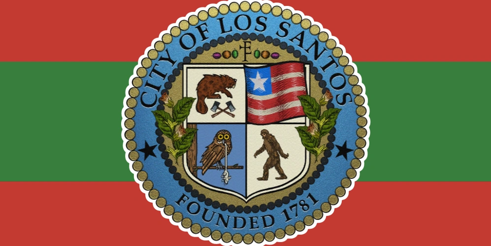

San Andreas, officially the State of San Andreas and sometimes referred to as the San Andreas Republic, is a state in the southwestern United States. Situated on the Pacific coast, it is known for its large population, cultural influence and varied geography, which includes major cities, agricultural valleys, forests, deserts, beaches and mountain ranges. Los Santos is its largest city and the principal economic and cultural centre of southern San Andreas.
San Andreas, officially the State of San Andreas, is a state located in the southwestern United States. It occupies part of the country’s Pacific coast and contains several large metropolitan areas, rural communities, agricultural regions, deserts, forests and mountain ranges.
The state’s largest city is Los Santos, which serves as the principal centre of government, finance, entertainment and international trade in southern San Andreas. Other recognised cities include San Fierro, while smaller communities such as Sandy Shores, Grapeseed, Paleto Bay and Chumash are located throughout the southern counties.
San Andreas is commonly known as the Golden State, and its residents are referred to as San Andreans. The beaver is the official state animal and appears on several state and local government symbols.
History
Before becoming part of the United States, the territory of San Andreas was controlled by Mexico and, earlier, by the Spanish Empire. This history contributed to the continued use of Spanish place names and the development of a large Hispanic population throughout the state.
Los Santos was founded in 1781 during the period of Spanish rule. Blaine County was established in 1823, while Los Santos County was formally organised in 1889.
American settlers later established the San Andreas Republic, which was subsequently incorporated into the United States as the State of San Andreas.
During the twentieth century, San Andreas became one of the country’s most influential cultural and economic centres. The growth of the Vinewood film industry established the state as a major centre for motion pictures, television, music and popular culture.
San Andreas also experienced several periods of civil unrest, particularly in its larger cities. These events influenced public discussions concerning racial inequality, policing, housing and government accountability.
Recreational cannabis was legalised in the state in 2021, following an extended period in which medical cannabis was already available through licensed businesses.
Geography
San Andreas is geographically diverse, with landscapes ranging from coastal beaches and forests to mountains, canyons, agricultural plains and desert regions.
Los Santos is located in the southern part of the state, separated from the Grand Senora Desert by the Vinewood Hills. The city and its surrounding metropolitan area occupy much of southern Los Santos County.
The Alamo Sea is a large saline lake situated within a basin bordered by several major mountain ranges. The communities of Sandy Shores and Grapeseed are located near the lake, while Mount Chiliad rises to the north.
Mount Chiliad is the highest known point in the state. Other prominent mountain areas include Mount Josiah, Mount Gordo, the San Chianski Mountain Range, the Tataviam Mountains and the Vinewood Hills.
Paleto Bay and Paleto Forest are located north of Mount Chiliad and are connected to the rest of southern San Andreas through the Great Ocean Highway, Braddock Pass and the Mount Chiliad Tunnel.
The western coastline contains long beaches extending from Vespucci and Del Perro to Chumash and Paleto Bay. The eastern coastline is more mountainous and is characterised by steep cliffs and isolated coastal areas.
Climate and environment
The state contains several climate zones as a result of its size and varied geography. Coastal communities generally experience mild conditions, while inland areas such as the Grand Senora Desert are hotter and considerably drier.
The northern forests are dominated by large redwood trees, while the mountains experience cooler temperatures and occasional snowfall.
San Andreas has experienced significant environmental problems, including air pollution, urban smog, wildfire risk and contaminated runoff near major population centres.
Counties
San Andreas contains several counties, each with its own local government and distinct geographical character.
Los Santos County
Los Santos County is the southernmost and most heavily developed county in the state.
It includes the City of Los Santos and the communities of Davis, Del Perro and Rockford Hills, together with coastal areas, highlands, beaches and an extensive network of urban freeways.
The county is the principal population, financial and cultural centre of southern San Andreas. It borders Blaine County to the north near Route 68.
Blaine County
Blaine County is a predominantly rural county located north of Los Santos County.
Its geography includes the Grand Senora Desert, the Alamo Sea, Paleto Forest and several mountainous regions. Its principal towns are Sandy Shores, Grapeseed and Paleto Bay.
Mount Chiliad is one of the county’s most prominent natural landmarks. Blaine County is also associated with agriculture, forestry, mining, tourism and outdoor recreation.
Red County
Red County is one of the recognised counties of San Andreas. Limited public information is available concerning its boundaries, population and administrative structure.
Flint County
Flint County is a recognised county within San Andreas. Like Red County, relatively little information is publicly available concerning its communities and government.
Cities and towns
Los Santos
Los Santos is the largest city in San Andreas and the county seat of Los Santos County.
The city is a major international centre for entertainment, finance, fashion, tourism and maritime trade. Vinewood, located within Los Santos, is widely regarded as the centre of the state’s film and television industries.
San Fierro
San Fierro is a major city located outside southern San Andreas. It is an important population and commercial centre, although less information is publicly available concerning its government and administrative divisions.
Sandy Shores
Sandy Shores is a small desert town situated on the southern shore of the Alamo Sea.
The town serves as a local centre for the surrounding Grand Senora Desert and contains residential, commercial and aviation facilities.
Grapeseed
Grapeseed is an agricultural town located northeast of the Alamo Sea.
Its economy is primarily based on farming, livestock and related rural industries. The surrounding area contains fields, ranches and agricultural processing facilities.
Paleto Bay
Paleto Bay is the northernmost major town in southern San Andreas.
Located near Mount Chiliad and Paleto Forest, it serves as an important stop along the Great Ocean Highway. The town supports forestry, tourism and services for travellers passing through the northern region.
Chumash
Chumash is a coastal community located west of Los Santos.
The town is known for its beachfront properties, docks and access to the Great Ocean Highway. It is primarily residential, although tourism and hospitality also contribute to its local economy.
Unincorporated communities
San Andreas contains several communities that do not maintain independent municipal governments.
Known unincorporated communities include Harmony, Galilee, Tongva Hills, Cape Catfish, Dignity Village and Stab City. Services in these areas are generally provided by county or state authorities.
Demographics
San Andreas has a large and culturally diverse population.
Los Santos contains substantial Black, Hispanic, Asian and immigrant communities. South Los Santos is home to a large Black population, while East Los Santos has a significant Hispanic community. Little Seoul is associated with Korean and other Asian communities.
The affluent districts of Rockford Hills, Richman and Vinewood Hills are home to many entertainers, business executives and other wealthy residents.
Blaine County is considerably less densely populated. Grapeseed is primarily agricultural, while Sandy Shores and the desert communities contain a mixture of long-term rural residents and people who have relocated from the larger cities.
Economy
The economy of San Andreas is highly diversified.
Entertainment is one of the state’s most internationally recognised industries. Vinewood supports film studios, television production companies, music labels, talent agencies and related creative businesses.
Los Santos is also a major centre for banking, finance, real estate, fashion, media and professional services.
The Port of Los Santos handles substantial volumes of international cargo, while Los Santos International Airport connects the state with domestic and international destinations.
Agriculture is particularly important in rural areas such as Grapeseed, where farms produce crops and support livestock operations. Tourism is another major industry, supported by the state’s beaches, mountains, forests, cultural institutions and entertainment venues.
Transportation
San Andreas has an extensive network of interstate highways, state routes, freeways and rural roads.
Major routes include the Great Ocean Highway, Route 68 and the freeways serving the Los Santos metropolitan area. These roads connect Los Santos with Blaine County and communities farther north.
The state’s roads are patrolled by the San Andreas Highway Patrol.
Air transportation
Los Santos International Airport is the principal passenger airport in southern San Andreas and one of the state’s most important transportation hubs.
Additional aviation facilities include Sandy Shores Airfield and McKenzie Field in Grapeseed. Fort Zancudo operates as a military airfield.
Maritime transportation
The Port of Los Santos is the state’s principal commercial seaport. It supports international shipping, cargo handling, shipbuilding and related industrial activity.
Natural areas
San Andreas contains numerous protected wilderness areas and natural landmarks.
Major natural areas include the Chiliad Mountain State Wilderness, Grand Senora Desert, Paleto Forest, Raton Canyon, Banham Canyon, Tongva Valley and the San Chianski Mountain Range.
The state’s lakes and waterways include the Alamo Sea, Lago Zancudo, Cassidy Creek and the Zancudo River.
These regions support hiking, hunting, fishing, boating, climbing and other forms of outdoor recreation.
Wildlife
San Andreas supports a wide variety of wildlife across its coastal, desert, mountain and forest environments.
Common species include deer, coyotes, cougars, wild boars, rabbits, sharks, fish, seabirds and other native birds. Domestic and agricultural animals, including cattle, pigs and chickens, are also common in rural areas.
The beaver is the official state animal.
Culture
San Andreas has played an important role in the development of American entertainment and popular culture.
Vinewood became the centre of the state’s film industry during the twentieth century and continues to attract actors, directors, musicians and other creative professionals from around the world.
Los Santos is also known for its fashion, music, nightlife, museums and professional sports. The state’s cultural identity varies considerably between its large cities, suburban communities, rural towns and coastal areas.